
I’ve seen too many security projects fail because the camera couldn’t tell a bicycle from a pedestrian. Non-motorized vehicles move differently, and most basic PTZ systems just can’t keep up.
Yes, our industrial-grade AI PTZ cameras1 fully support intelligent recognition, classified tracking, and path analysis for non-motorized vehicles like bicycles, e-bikes, and scooters. The deep learning model treats them as a separate object class with unique motion behavior, enabling precise trajectory capture and real-time alerts.
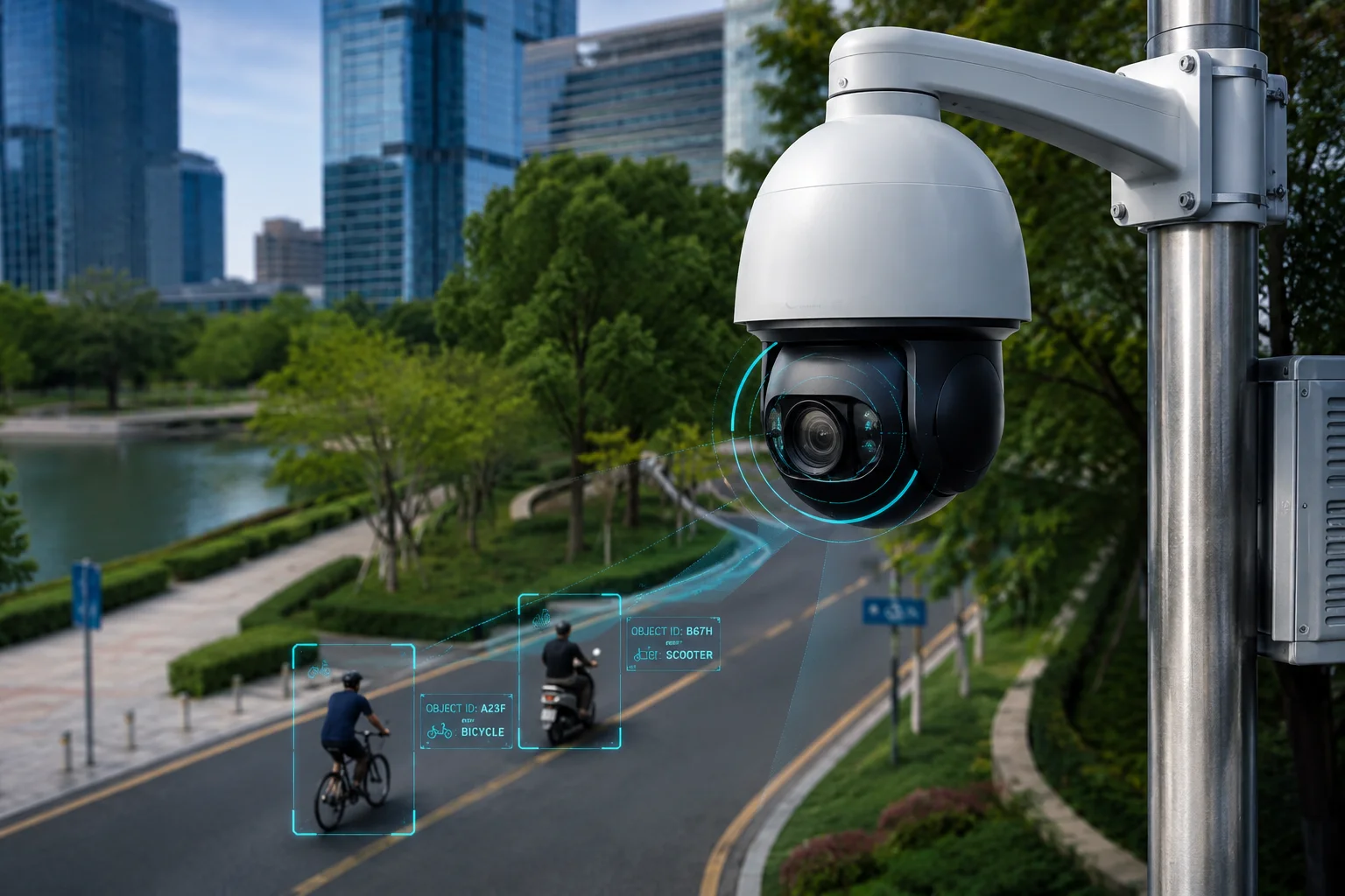
Below, I’ll walk you through the exact capabilities our system offers. I’ll answer the most common questions we get from integrators and project managers who need to track non-motorized traffic in parks, farms, warehouses, and urban areas.
Table of Contents
Can the PTZ Follow a Suspicious Person on a Scooter Through a Busy Park Area?
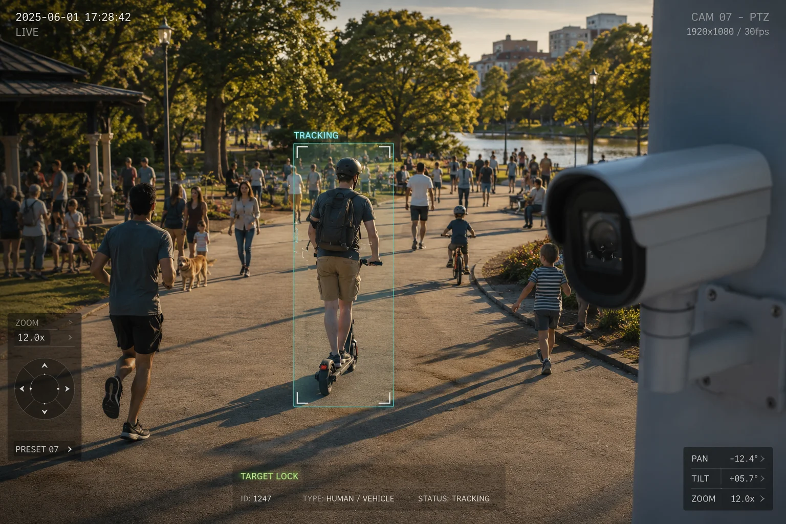
Busy parks are a nightmare for traditional PTZ cameras. People walking dogs, kids running, joggers crossing paths. I’ve watched systems lose a scooter target within seconds because the algorithm couldn’t separate it from the crowd.
Our PTZ camera uses a combined-object detection model that locks onto the rider-plus-vehicle as one unified target. Even in crowded park environments with dozens of moving objects, the system maintains stable tracking by predicting the scooter’s motion vector and filtering out pedestrian noise.
How the System Handles Crowded Scenes
The core challenge in a park scenario is object density. You might have 30 or 40 people in the frame at once. A basic motion-detection camera would jump between targets or lose the scooter entirely. Our firmware solves this with a layered approach.
First, the AI classifier runs on every detected object in the frame. It assigns each one a category: pedestrian, bicycle, e-bike, scooter, or vehicle. This happens in real time at the edge, not in the cloud. There’s no round-trip delay.
Second, once you select a target (or the system auto-selects based on your rules), the tracker uses what we call motion vector prediction2. It looks at the scooter’s speed and direction over the last few frames. Then it calculates where the scooter will be in the next 200 milliseconds. The pan-tilt motor starts moving before the scooter actually gets there.
Why “Combined Object” Detection Matters
Here’s a problem I’ve seen on many job sites. A rider gets off the scooter and starts pushing it. A basic tracker sees two separate objects now: a person and a vehicle. It doesn’t know which one to follow. Sometimes it switches IDs entirely.
Our algorithm treats the rider and vehicle as one combined object. When the rider dismounts, the system keeps both in frame and maintains the same tracking ID3. No ID switch. No lost target.
Key Tracking Parameters for Park Deployments
| Parameter | Value | Why It Matters |
|---|---|---|
| Max tracked objects | 30 simultaneous | Handles crowded park scenes without dropping targets. |
| Re-acquisition time | < 2 seconds | If a tree briefly blocks the view, the system finds the target again fast. |
| Tracking speed | Up to 200°/sec pan | Keeps up with scooters moving at 25 km/h across the field of view. |
| ID retention | Maintains through occlusion | Target ID stays the same even after temporary blockage. |
The Role of 4G in Remote Park Monitoring
Many park installations don’t have wired internet. Our 4G LTE module4 sends alerts and short video clips to your phone or VMS within seconds. The tracking runs locally on the camera. It doesn’t need the network to follow the target. The network is only used for notifications and remote viewing.
Will the System Log the “Path History” of a Bicycle for Post-Event Forensic Review?
After an incident, the first question is always: “Where did they come from, and where did they go?” I’ve had clients lose insurance claims because their old cameras had no way to show a bicycle’s route through the property.
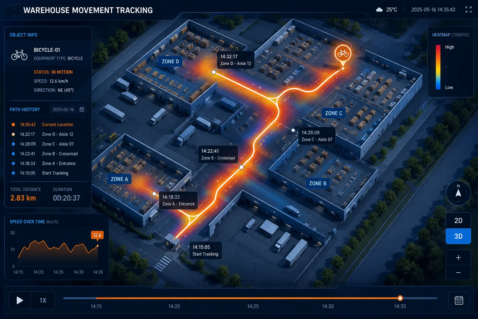
Yes, the system records full path history for every tracked non-motorized vehicle. You can replay the trajectory on a map overlay, export structured GPS-referenced data, and use heatmaps to identify repeated travel patterns over days or weeks.
How Path History Gets Recorded
Every time the AI tracker locks onto a non-motorized vehicle, it starts logging position data. This includes the object’s pixel coordinates in the frame, the corresponding pan-tilt-zoom position of the camera, and a timestamp accurate to the millisecond.
This data gets stored locally on the camera’s SD card or pushed to your NVR. When you need to review it later, you open the playback interface and see the bicycle’s path drawn as a line on the video frame. You can scrub forward and backward through time.
Structured Data Export
For forensic work5, a video clip alone isn’t always enough. Our system exports the path data as a structured file6. This means you get a table of timestamps, coordinates, and speed values. You can import this into your own analysis software or hand it to law enforcement.
Heatmap Analysis for Long-Term Patterns
The heatmap feature is where this gets really useful for B2B clients. Let’s say you manage a warehouse complex. Over 30 days, the system collects every bicycle and e-bike path that crosses your property. It then generates a heatmap7 showing the most common routes.
This tells you things like:
- Are delivery riders cutting through a restricted zone every morning?
- Is there a gap in your fence line that people on bikes use regularly?
- Do certain paths only appear at night?
Forensic Review Workflow
Here’s the typical workflow I recommend to our integrator partners:
- An incident happens. You get an alert or a report.
- You open the NVR and search by object type: “bicycle” or “e-bike.”
- You set the time window. The system shows all tracked paths during that period.
- You select the relevant path and export the video clip plus the data file.
- You hand both to your client or to law enforcement.
This entire process takes minutes, not hours. You don’t need to scrub through 24 hours of footage manually.
Path Data Specifications
| Feature | Detail | Benefit |
|---|---|---|
| Storage format | JSON / CSV export | Easy to import into any analysis tool. |
| Retention period | Up to 90 days on NVR | Covers most investigation timelines. |
| Heatmap generation | Daily / Weekly / Monthly | Shows long-term behavior patterns. |
| Search filters | Object type, time, zone | Find the exact event in seconds. |
| Coordinate system | PTZ position + pixel map | Allows spatial reconstruction of the path. |
How Does the Tracker Distinguish Between a Bike Path and a Pedestrian Walkway?
This is a question I get from almost every city planner and campus security manager. They don’t just want to track objects. They want the system to understand where those objects should and shouldn’t be.
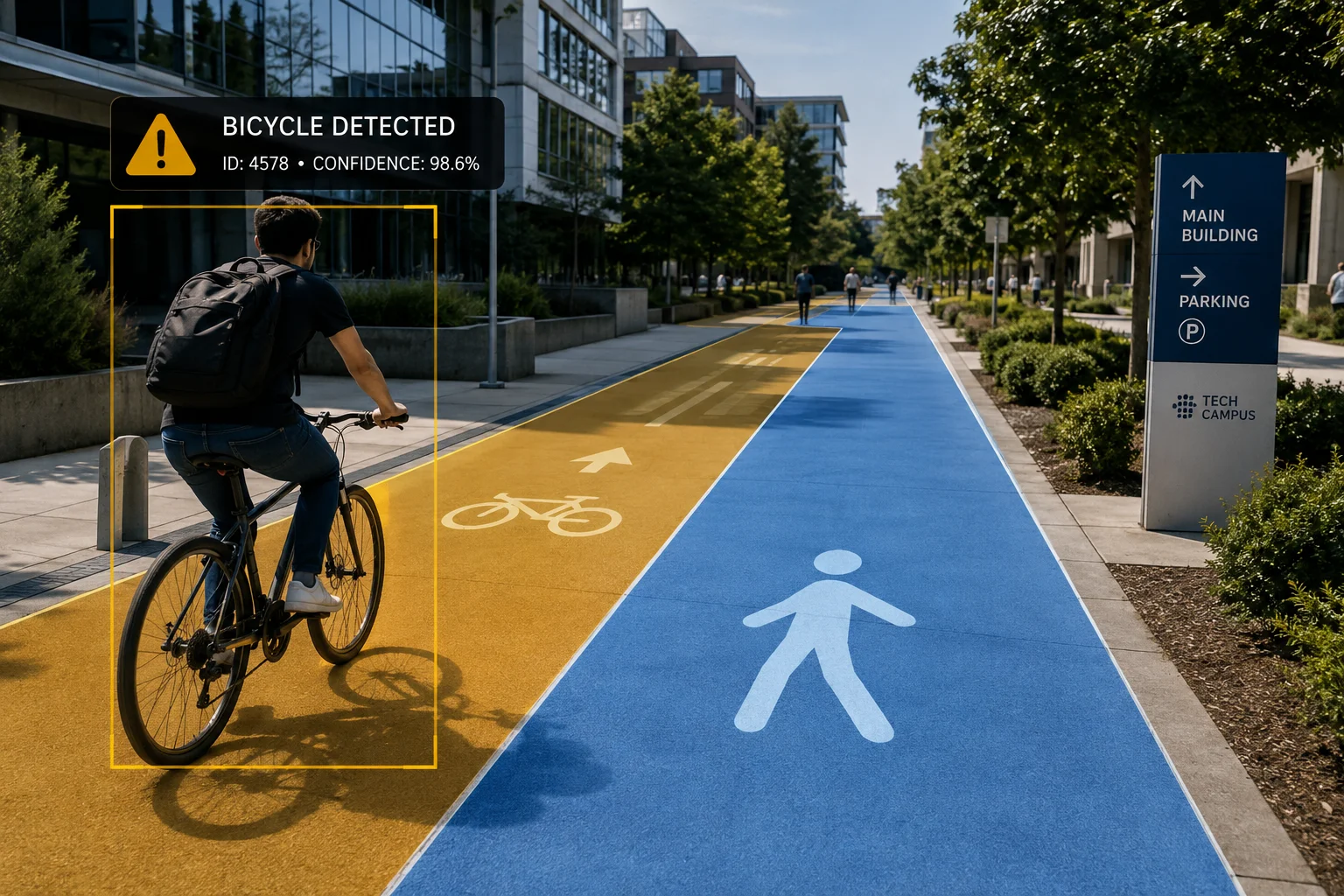
The system uses user-defined zone mapping combined with object classification. You draw zones on the camera’s live view and assign rules to each zone. If a bicycle enters a pedestrian-only zone, or a pedestrian walks on a bike path, the camera triggers a specific alert based on the violation type.
Zone-Based Rule Engine
The camera’s web interface lets you draw polygons directly on the live video feed. Each polygon becomes a named zone. You then assign rules to that zone. For example:
- Zone A (Bike Path): Allow bicycles and e-bikes. Alert if a pedestrian lingers for more than 10 seconds.
- Zone B (Pedestrian Walkway): Allow pedestrians. Alert immediately if any non-motorized vehicle enters.
- Zone C (Shared Path): Allow both. No alerts for normal traffic. Alert only if speed exceeds a threshold.
This zone logic runs entirely on the camera’s processor. It doesn’t need a server or cloud connection to make decisions.
How Classification Works at the Edge
The AI model running on our camera’s NPU (Neural Processing Unit)8 classifies every moving object into one of several categories. For non-motorized vehicles, it looks at shape, size, aspect ratio, and motion pattern. A bicycle has a very different silhouette than a walking person. An e-bike is wider and moves faster than a pedestrian.
The classifier updates its decision every frame. So if someone gets off their bike and starts walking, the system reclassifies them from “cyclist” to “pedestrian” within about one second. This means the zone rules still apply correctly.
Handling Edge Cases
Real-world deployments always have edge cases. Here are the ones I’ve seen most often and how the system handles them:
- Person pushing a bike: Classified as “pedestrian with object.” The system can be configured to treat this as either a pedestrian or a cyclist, depending on your preference.
- Skateboard or rollerblades: These fall under the pedestrian category by default. If you need them treated separately, our firmware supports custom class training for OEM partners.
- Wheelchair or mobility scooter: Classified separately from recreational scooters. The system won’t trigger a “non-motorized vehicle” alert for mobility devices.
Why This Matters for Liability
If you’re an integrator delivering a campus security project, your client needs proof that the system can enforce path separation. This isn’t just about convenience. It’s about liability. If a cyclist hits a pedestrian on a walkway, the property owner may face legal questions about whether they had adequate monitoring and enforcement.
Our zone-based alerts give your client a documented record. They can show that the system detected the violation and sent an alert. That’s a strong position in any liability discussion.
Can I Set a “Speed Threshold” to Ignore Slow-Moving Non-Motorized Traffic?
False alerts kill trust in any security system. I’ve had clients disable their entire alert system because they were getting 200 notifications a day from slow-moving bicycles that posed zero threat.
Yes, you can set minimum and maximum speed thresholds for non-motorized vehicle alerts. The system calculates each object’s real-world speed using calibrated pixel-to-distance mapping. Objects moving below your threshold are ignored, and objects exceeding it trigger immediate alerts.

How Speed Calculation Works
The camera doesn’t have a radar gun built in. Instead, it uses a calibration process. During setup, you tell the system the real-world distance between two reference points in the frame. Maybe it’s the width of a road, or the distance between two fence posts.
Once calibrated, the system can convert pixel movement into real-world speed. If a bicycle moves 50 pixels in one second, and the system knows that 50 pixels equals 5 meters, then the bike is moving at 5 m/s (about 18 km/h).
This calculation runs continuously for every tracked object. The accuracy is within about 10% for objects moving perpendicular to the camera’s line of sight. Objects moving directly toward or away from the camera are harder to measure, but the system compensates using zoom-level data.
Setting Up Speed Rules
In the camera’s configuration interface, you’ll find the speed threshold settings under the “Smart Event” menu. Here’s what you can configure:
- Minimum speed: Objects below this speed won’t trigger alerts. Set this to 5 km/h to ignore parked bikes or people slowly pushing a cart.
- Maximum speed: Objects above this speed trigger a high-priority alert. Set this to 30 km/h to catch e-bikes racing through a restricted zone.
- Speed + Zone combination: You can apply different thresholds to different zones. A bike path might allow up to 25 km/h, while a loading dock area might alert at anything above 10 km/h.
Practical Examples
Here’s how I’ve seen clients use speed thresholds in real deployments:
Farm perimeter: The client had workers on bicycles moving slowly along the fence line every morning. These were authorized. But anyone moving fast (above 20 km/h) along the perimeter was suspicious. Setting a 20 km/h minimum threshold eliminated all the routine alerts while still catching intruders.
Warehouse loading zone: Forklifts and delivery bikes share the same space. The client set a 15 km/h maximum threshold. Any non-motorized vehicle exceeding that speed in the loading zone triggered an alert, because it meant someone was riding recklessly near heavy equipment.
School campus: The school wanted to know about any e-bike or scooter on campus, regardless of speed. They set the minimum threshold to 0 km/h for the campus zones. But on the adjacent public sidewalk (also in the camera’s view), they set a 10 km/h minimum to avoid alerts from passing pedestrians with strollers.
Speed Threshold Configuration Summary
| Setting | Range | Default | Use Case |
|---|---|---|---|
| Min speed trigger | 0–50 km/h | 5 km/h | Ignore parked or very slow objects. |
| Max speed trigger | 5–100 km/h | 40 km/h | Catch fast-moving threats. |
| Zone-specific override | Per zone | Inherits global | Different rules for different areas. |
| Alert priority | Low / Medium / High | Medium | High for speed violations in sensitive zones. |
| Calibration accuracy | ±10% | — | Best for perpendicular movement to camera. |
Reducing False Alerts Without Missing Real Threats
The goal of speed thresholds is simple: fewer useless notifications, more actionable alerts. In my experience, a well-configured speed threshold reduces false alerts by 60–80% in most non-motorized vehicle scenarios. That means your monitoring team actually pays attention when an alert comes in, because they trust it’s real.
Combined with object classification (so you’re only alerting on bikes, not dogs or blowing trash) and zone rules (so you’re only watching the areas that matter), speed thresholds complete the filtering stack. You end up with a system that only bothers you when something genuinely unusual is happening.
Conclusion
Our AI PTZ cameras track non-motorized vehicles with classified detection, path logging, zone-based rules, and speed filtering. Every feature runs at the edge for real-time response, even on 4G solar-powered deployments in remote locations.
1. Learn the fundamentals of PTZ camera technology, including pan, tilt, and zoom capabilities. ↩︎ 2. Explore how motion estimation is used to predict object movement and improve tracking accuracy. ↩︎ 3. Learn how persistent tracking IDs maintain object identity across frames and through occlusions. ↩︎ 4. Understand the role of LTE in enabling remote connectivity and real-time alerts from field cameras. ↩︎ 5. Explore how forensic video analysis is used to reconstruct events and support investigations. ↩︎ 6. Learn about structured file formats like CSV used for exporting path data for post-event analysis. ↩︎ 7. Learn how heatmaps visualize frequency and patterns of tracked object routes over time. ↩︎ 8. Understand how dedicated AI processors enable real-time edge inference for object classification. ↩︎